Aerial Surveillance Has Many Applications
Aerial Surveillance Has Both Domestic and Military Uses. The Growing NWO Police State Will Use Military Technology for a Quiet Lock-Down of Free Society.
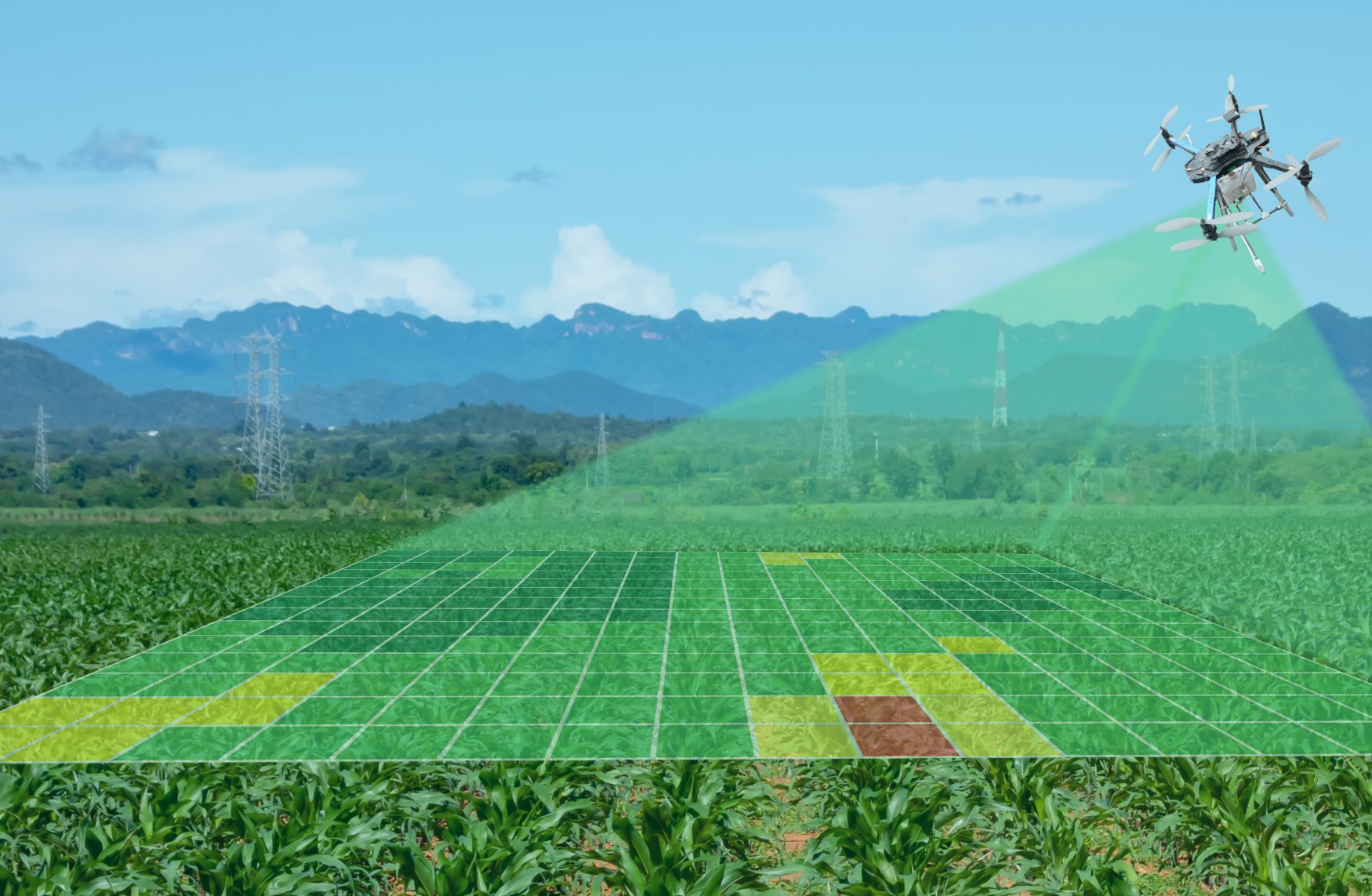
Aerial surveillance used by farmers to monitor their crops is a benign and beneficial way to use this technology.
Unfortunately, this technology is used to spy on American citizens. The tools used by Big Brother leave us no privacy.
Both staffed and unmanned aircraft spying have numerous applications and most serve the military and government.
The few truly beneficial uses to the farmer and the monitoring of forest fires etc., are enough reasons for the citizens to support and be minimally concerned as the aircraft fly around and about.
Applications that support Homeland Security, border patrol, and illegal checkpoints go unnoticed by most civilians as a threat to their privacy and freedom is flying all around them.
Aerial surveillance has numerous military applications and automated UAVs (acronym for unmanned air vehicles) are in use around the globe.
UAVS Use for Surveying Crops
In 1990, farmers began using an airborne video system developed by the USDA to monitor their crops.
The video system is cheaper than using satellite images or traditional photography and pinpoints the target, in this case perhaps an insect infestation.
The USDA stated that in a few years the farmers would be able to act more quickly to protect their crops as the aerial surveillance technology developed.
Translate this back to the military and it is not difficult to see how the farmers were used as test pilots to hone the capabilities of military UAVs to locate a very small target and to act more quickly in attacking that target.
The video system developed at the USDA’s Remote Sensing Research Laboratory in Texas is comprised of high-resolution cameras mounted inside an Aero Commander Plane.
The CAESAR Project: A Nato Spy Program
CAESAR is an acronym for Coalition Aerial Surveillance and Reconnaissance.
The United States customs indicated that they required a sensing and monitoring system for air vehicles to survey the United States border with Mexico to bring down illegal drug operations.
CAESAR is an intelligence, surveillance, and reconnaissance project that all seven nations of NATO work with to exchange, integrate, and exploit the data received from manned and unmanned aircraft.
The seven nations of NATO are the United States, Canada, France, Germany, Italy, Norway, and the United Kingdom.
The CAESAR Project: Objectives for the Project
The NATO alliance has very specific objectives for the CAESAR project and one of them is to produce tactics, techniques, and procedures by forming a coalition among the seven nations to employ multinational military ground deployments.
The project has existed formally since 2000 and became active during 1995.
The project started at The Hague in Netherlands and in 1997 France hosted the NATO nations in an interoperability experiment.
This experiment had a variety of aircraft and ground stations gathering and exchanging information regarding the movement on the ground.
The NATO nations have been preparing and using aerial surveillance in their war efforts, border controls, and for manufactured homeland security.
Should the dire economic picture get so bad that people start to revolt these nations are prepared.
 My First Amazing Ayahuasca Experience
  Pine Needle Tea
  The REAL Controllers of Humanity: The Papal Bloodlines
  Is it Global Warming or Cooling?
  Gun Rights and Obama Examined