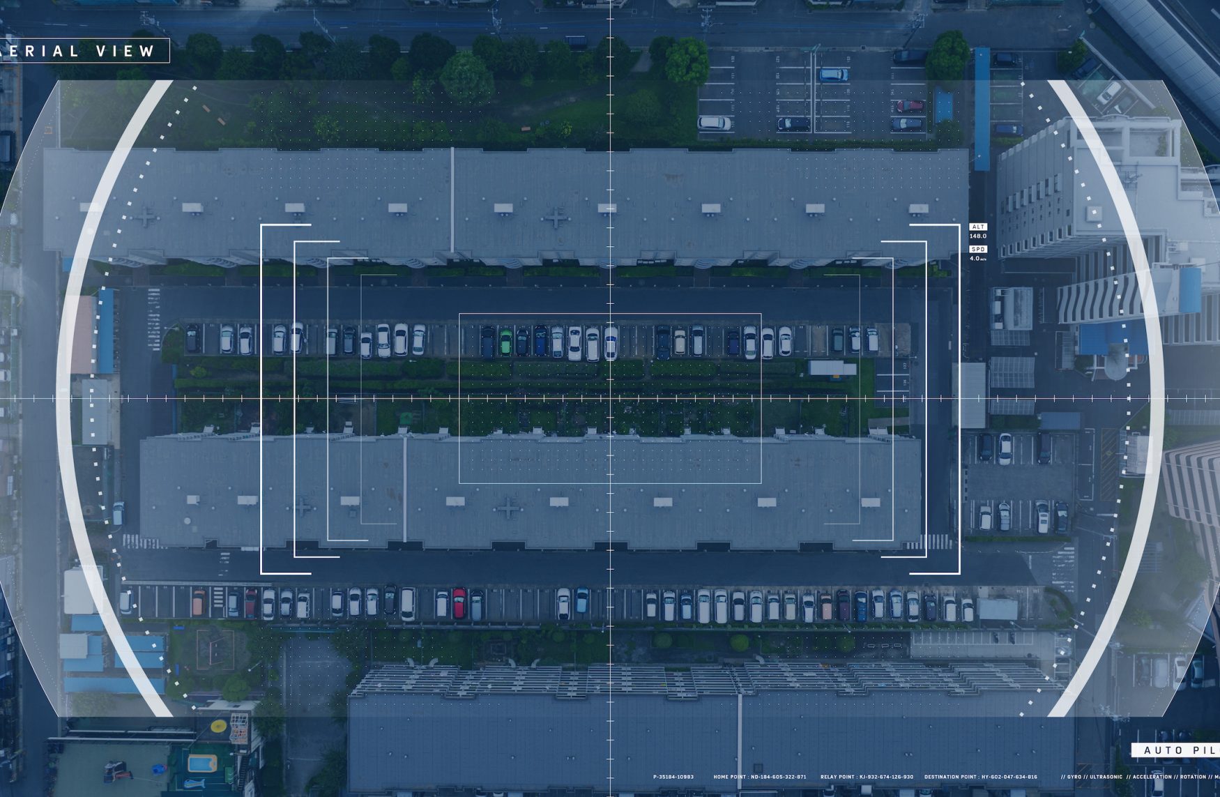
U.S. Uses Spy Satellite Imagery
Spy Satellite Imagery is Readily Available to Those Who Have Internet Access, but Governmental Control Will Not Allow Citizens to View Images Deemed Sensitive.
The following quote is a comment made in reference to spy satellite imagery by the head of the U.S. spy satellite authority regarding intelligence gathering methods.
“We are told that, “National security is a serious matter which may have to force the implementation of censorship of commercial spy satellite imagery”.”
– leading U.S. spy satellite authorites.
There are some situations, according to him, which would require restrictions on open dissemination of images due to the sensitivity of these sites, be they located within the United States or overseas.
Pixilation censorship is something the little-known spy authority has been considering for a very long time.
It funds many commercial imagery corporations such as Google Earth, however, it restricts the resolution of such images.
When need arises, the organization chooses to keep information from websites because it has the financial and legal backing of the United States.
In the case of communications, covert exchange of information is vital for people and nations to address matters of common interest.
To protect their security, spy satellite imagery technology makes use of code names, passwords and radar imaging approaches that conceal information.
Economic Sabotage
When the U.S. was planning to invade Afghanistan in order to topple the Taliban regime, the agency bought all the satellite imagery that covered that country.
For a few months, the resulting local blackouts impacted private interests.
Relief work had to stop and there was public outcry.
This was an information war and the people who win had to be equipped with necessary legal and financial might.
These capabilities were the reserve of the U.S. government and there were attempts to try to fool the world into believing that it was a war against terrorism.
The Lacrosse Radar
The Lacrosse radar, a spy satellite centre, is under construction.
It is a satellite for earth observations deployed for both military and civilian spying purposes.
These are reconnaissance satellites with space telescopes which are directed towards the earth and not the outer space.
The photographic canisters ejected by these satellites have the ability to reach the earth.
Corona is an example of a first generation satellite, which released capsules that needed to be intercepted in mid-air as they floated around in parachutes.
Later on, spacecraft had improved imaging sensors with digital support that worked through encryption or radio links.
Information Leakage
Spying programs that provide information for the United States have existed since 1972.
Prior to this time, the existing information still remains classified.
It only trickles in when subsequent missions need to be guided by past experiences.
Leakage of information is another way in which spy satellite imagery finds its way into the hands of enemy countries.
Such a leakage was witnessed in 1985 when k11 photographs were provided for publication in American magazines.
In 1955, the U.S. Air Force officially ordered the establishment of surveillance machinery that would provide a counter measure to the Russian Sputnik, the first object that man launched into space.
Reconnaissance missions include photography, communications and eavesdropping.
 My First Amazing Ayahuasca Experience
  Pine Needle Tea
  The REAL Controllers of Humanity: The Papal Bloodlines
  Is it Global Warming or Cooling?
  Gun Rights and Obama Examined